2022
StoryMap
ArcGIS Online

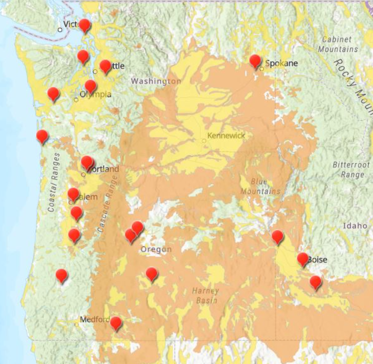
Contamination Sites Located in the Pacific Northwest Region
2021
NDVI Image Analysis (New Orleans)
Landsat Explorer / Living Atlas
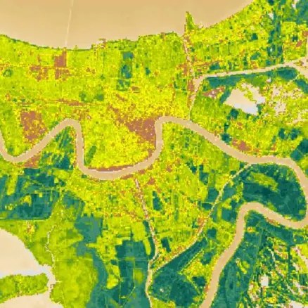
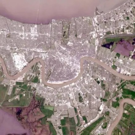
Left to right: NDVI band (Near Infrared – Red) / (Near Infrared + Red), vegetation mask value of 0.45 (rich vegetation areas in green); Natural Color band; Study Area in blue.
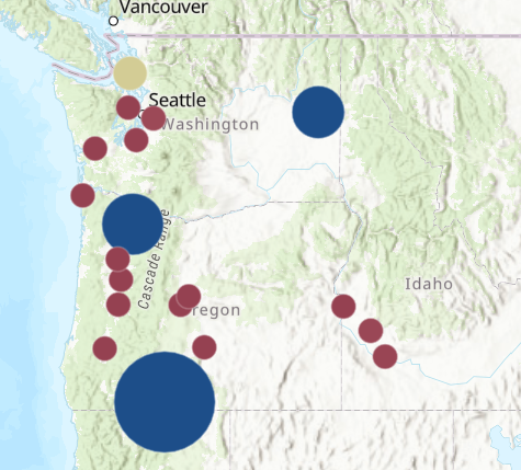
2020
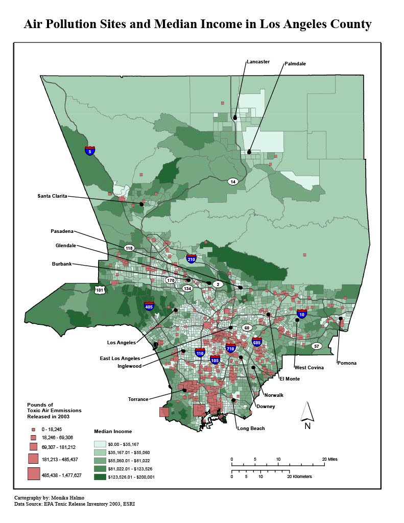
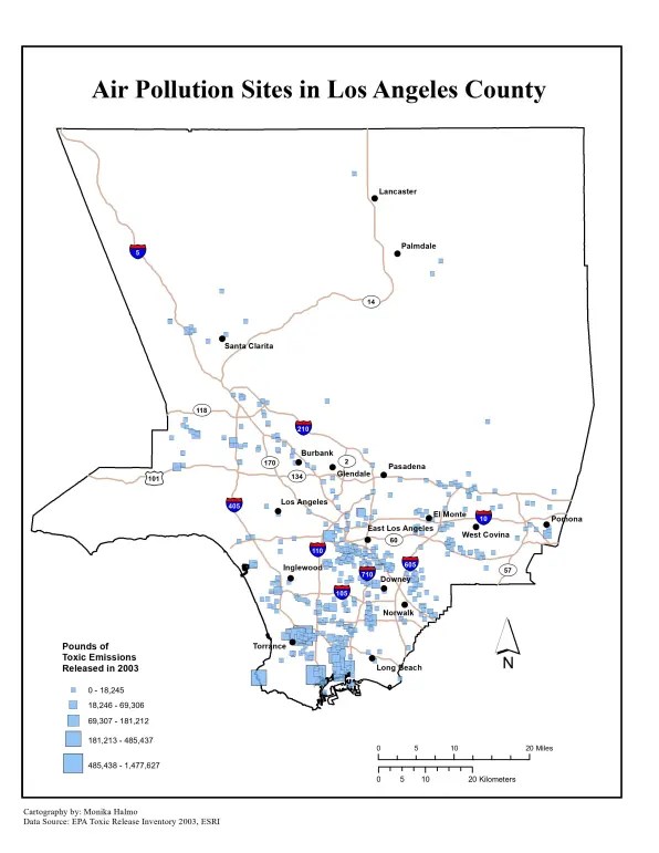
Spatial Relationship Between Air Pollution and Income in LA County
ArcGIS Desktop

2019-20
Remote Sensing Image Analysis
ArcGIS Desktop
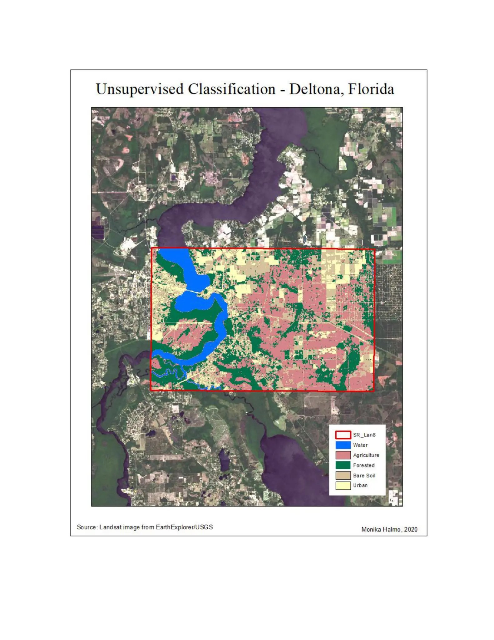
Unsupervised Classification
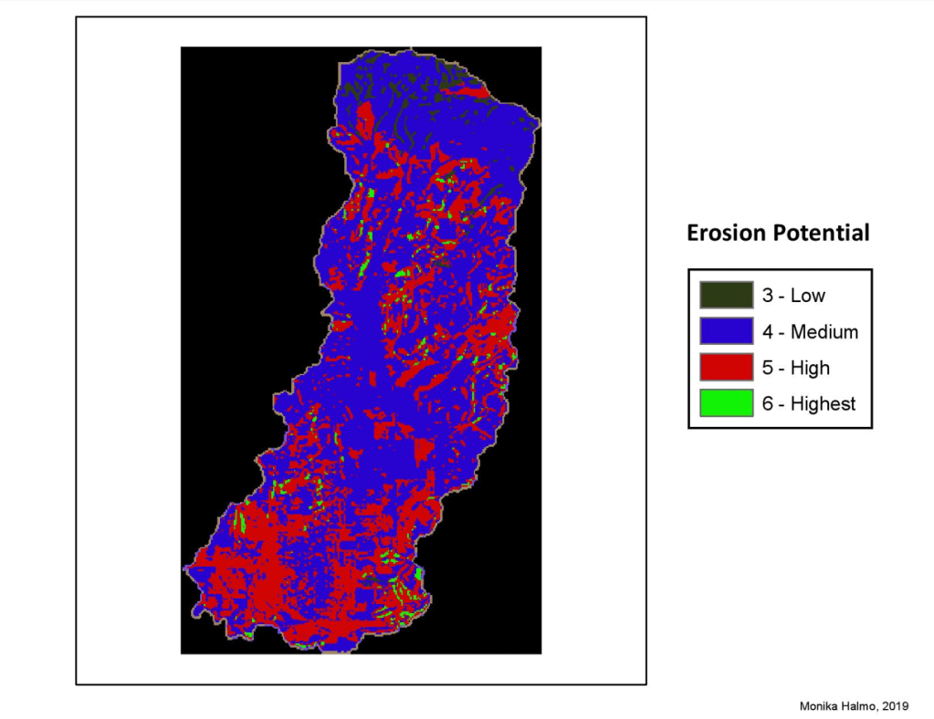
Watershed Erosion Potential
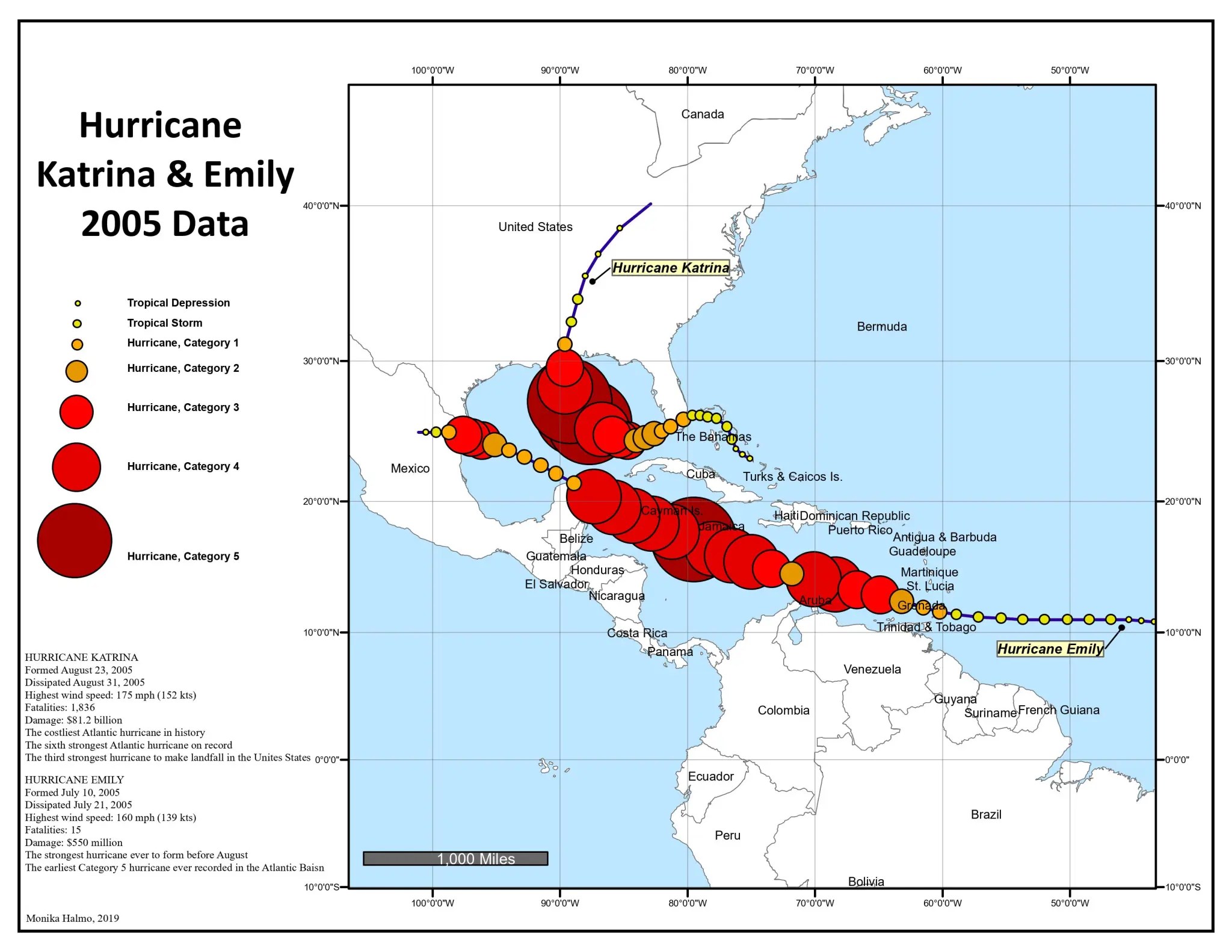
2019
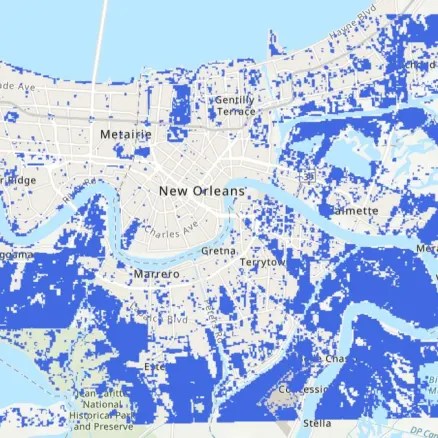
Hurricane Data
ArcGIS Desktop